Charts&Tides
Charts&Tides for iOS 7 now in the App Store!
2014 Jan 09
The all new Charts&Tides for iOS 7 is now available for FREE download in the App Store.
The software is a FREE download, but does not come prepackaged with any detailed marine charts. You can purchase detailed marine charts from within the application. Currently there are charts for US and Canada available. You can also use the software without purchasing additional charts.
This latest version is a complete overhaul over prior versions. It has been designed with iOS 7 in mind and has an interface that is clean and intuitive. Despite its apparent simplicity it has a large feature set that is on par with the desktop version of Charts&Tides!
Here is some of the functionality offered in this release:
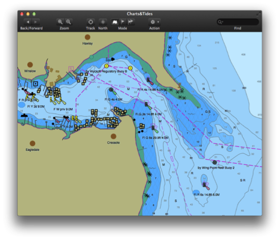
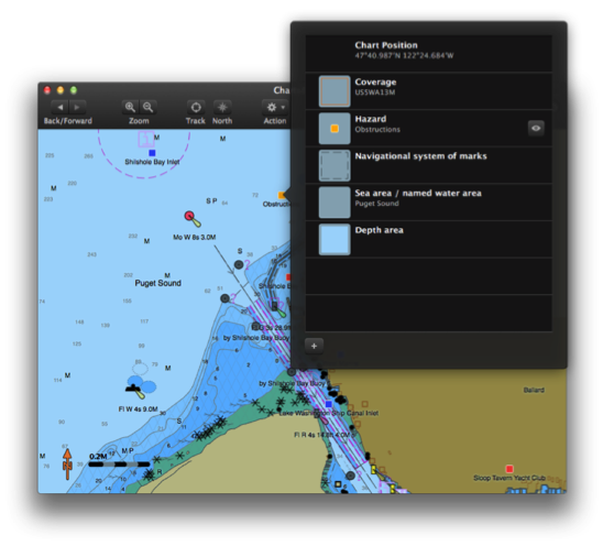
- Provides continuous and seamless large area charts derived from NOAA and CHS vector cartography.
- Shows tide levels and current speeds on the chart using easily interpreted icons. Allows you to judge the water situation around you with a single glance.
- Integrates with the ActiveCaptain interactive cruising guidebook providing you with access to thousands of marinas, anchorages, hazards and other local knowledge.
- Stores the entire ActiveCaptain database offline so that it is always available to you, even without an Internet connection.
- Allows you to instantly search thousands of chart features and the ActiveCaptain database.
- Supports waypoints, routes, tracks and allows you to import and export them in GPX format. Route navigation with automatic waypoint sequencing is also supported.
- Supports multiple options for navigation. You can use your device's built-in GPS or connect to an external GPS via Bluetooth or Wi-Fi. You can also use dead reckoning mode.
- Supports external AIS devices and performs Closest Point of Approach (CPA) computations.
- Comes with a dark UI that looks good during the day and will preserve your night vision when it is dark.
The software is a FREE download, but does not come prepackaged with any detailed marine charts. You can purchase detailed marine charts from within the application. Currently there are charts for US and Canada available. You can also use the software without purchasing additional charts.
Charts&Tides for Mac with AIS and Canada charts now out!
2013 Jul 12
The latest update of Charts&Tides for Mac is now in the App Store. This update brings the following new features:

We now also have Canada charts available as in an app purchase! Read more about them here.
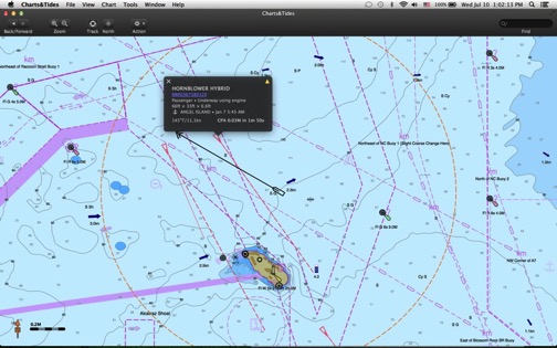
- Major new feature: AIS support and Closest Point of Approach (CPA) computations and alerts.
- Many more connectivity options for GPS (Wi-Fi, GPSD).
- Dead Reckoning Mode.
- Miscellaneous user interface improvements.
We now also have Canada charts available as in an app purchase! Read more about them here.
Charts&Tides for Mac now with AIS support
2013 Jul 10
A new update has been posted to the App Store and is currently undergoing review. This update brings a major new feature: AIS support complete with CPA computations and alerts. You can even set it so the computer can speak the alerts to you!
Available at the App Store soon.
Available at the App Store soon.
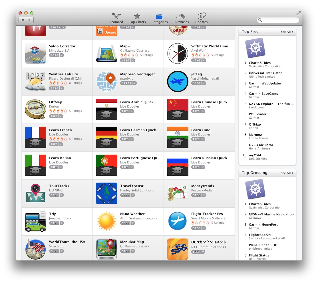
Charts&Tides for Mac is Number 1!
2013 May 29
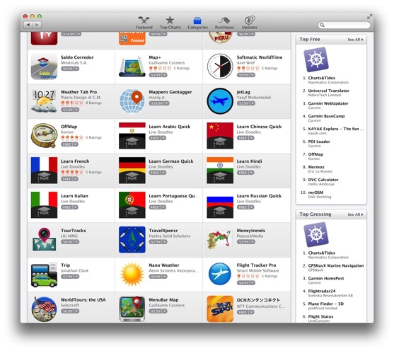
Charts&Tides is Number 1 in the Top Free and Top Grossing lists in the Travel category of the Mac App Store.
Click to find more about the software. Or you can simply download it for free.
Click to find more about the software. Or you can simply download it for free.
Charts&Tides for Mac now in the App Store!
2013 May 25
Charts&Tides for Mac has passed review from Apple and is now available in the Mac App Store.
Some of the functionality offered in this release:
The software comes with a world base map, but does not come prepackaged with any detailed marine charts. You can purchase detailed marine charts from within the application. You can also use the software without purchasing additional charts.
Additional features coming soon:
Click to find more about the software. Or you can simply download it for free.
Some of the functionality offered in this release:
- Provides continuous and seamless large area charts derived from NOAA and CHS vector cartography.
- Shows tide levels and current speeds on the chart using easily interpreted icons. Allows you to judge the water situation around you with a single glance.
- Integrates with the ActiveCaptain interactive cruising guidebook providing you with access to thousands of marinas, anchorages, hazards and other local knowledge.
- Stores the entire ActiveCaptain database offline so that it is always available to you, even without an Internet connection.
- Allows you to instantly search thousands of chart features and the ActiveCaptain database.
- Supports waypoints, routes, tracks and allows you to import and export them in GPX format.
- Supports GPS devices that transmit in the NMEA format. Route navigation with automatic waypoint sequencing is supported.
- Comes with a dark UI that looks good during the day and will preserve your night vision when it is dark.
The software comes with a world base map, but does not come prepackaged with any detailed marine charts. You can purchase detailed marine charts from within the application. You can also use the software without purchasing additional charts.
Additional features coming soon:
- Canada charts.
- AIS support and lots of options to connect GPS and AIS devices.
- Weather.
Click to find more about the software. Or you can simply download it for free.
Charts&Tides for Mac Public Beta!
2013 Apr 19
Over two years in the making, the first public beta of Charts&Tides for Mac is finally here. If you would like to participate in our beta testing program, click to send an email (the beta is now closed).
Features include:
Approved beta testers will receive a standalone package that contains Charts&Tides for Mac and the full USA chart. They will also have the opportunity to influence and improve Charts&Tides for Mac through their feedback.
Update: 2013 May 20
The beta is now closed. Thank you to everyone who participated.
Features include:
- Beautifully rendered vector chart derived from US NOAA Electronic Navigational Charts (ENC).
- Waypoints, Routes, Tracks.
- GPS navigation.
- Tides/currents.
- ActiveCaptain integration!
Approved beta testers will receive a standalone package that contains Charts&Tides for Mac and the full USA chart. They will also have the opportunity to influence and improve Charts&Tides for Mac through their feedback.
Update: 2013 May 20
The beta is now closed. Thank you to everyone who participated.
Charts&Tides for Mac coming soon!
2012 May 01
We are excited to announce the upcoming availability of Charts&Tides for the Mac. Built on top of our new GeoKit engine that renders beautiful charts and with a gorgeous new dark UI that makes for perfect day or night viewing. Available soon in the Mac App Store.