Navimatics offers quality navigation products for your Mac, iPad/iPhone, Android or Garmin* device. Our product line encompasses electronic aeronautical and marine charts and celestial navigation.
The 2016 charts are out. Get them in the AppStore.
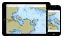
Charts&Tides for iOS
The all new Charts&Tides for iOS7 is finally here! Now get access to charts, tides, ActiveCaptain information, GPS navigation and more in a well designed package. Use it at home to research and plan your trip. Use it on your boat to navigate a route to your final destination.
Available now in the App Store. Read more or Download it.
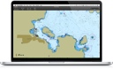
Charts&Tides for Mac
Charts&Tides is the new must-have marine navigation software for the Mac. It provides access to charts, tides, ActiveCaptain information, GPS navigation and more in a well designed and integrated package. Use it at home to research and plan your trip or add a GPS device and use it on your boat to navigate a route to your final destination.
Available now in the Mac App Store. Read more or Download it.
Celestial
Celestial is a complete package for celestial navigation on your iPad, iPhone, iPod Touch or Android device. It can perform celestial sight reductions, calculate fixes, present them visually, manage sights on multiple trips and assist in sight planning. It also includes a complete Almanac of the Sun, Moon, planets and stars. All this for the price of the Nautical Almanac for a single year!

Aero Charts
Aero Charts incorporates VFR+IFR chart data derived from official FAA and other government data and includes Class B, C, D, E and Special Use Airspace, Airways, Fixes, Holding Patterns, Navaids and Airports as well as hypsography and important land features. The product includes full flight plan support with automatic waypoint sequencing (when device GPS is available).
Garmin Compatible Charts
Navimatics sells marine charts for your Garmin* marine GPS device and Garmin MapSource*. We cover the US coastline including the Great Lakes region. Our charts are derived from NOAA Electronic Navigational Charts (ENC), are updated regularly and they cost less and cover much greater regions than Garmin BlueCharts*.