Charts&Tides for Mac Public Beta!
2013 Apr 19 Filed in: Charts&Tides
Over two years in the making, the first public beta of Charts&Tides for Mac is finally here. If you would like to participate in our beta testing program, click to send an email (the beta is now closed).
Features include:
Approved beta testers will receive a standalone package that contains Charts&Tides for Mac and the full USA chart. They will also have the opportunity to influence and improve Charts&Tides for Mac through their feedback.
Update: 2013 May 20
The beta is now closed. Thank you to everyone who participated.
Features include:
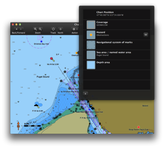
- Beautifully rendered vector chart derived from US NOAA Electronic Navigational Charts (ENC).
- Waypoints, Routes, Tracks.
- GPS navigation.
- Tides/currents.
- ActiveCaptain integration!
Approved beta testers will receive a standalone package that contains Charts&Tides for Mac and the full USA chart. They will also have the opportunity to influence and improve Charts&Tides for Mac through their feedback.
Update: 2013 May 20
The beta is now closed. Thank you to everyone who participated.