Charts&Tides for Mac is Number 1!
2013 May 29 Filed in: Charts&Tides
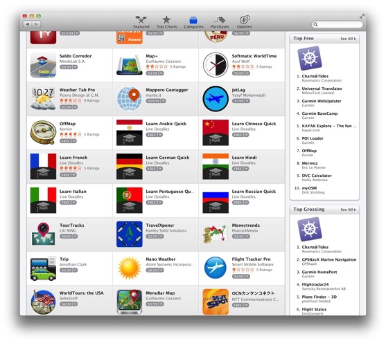
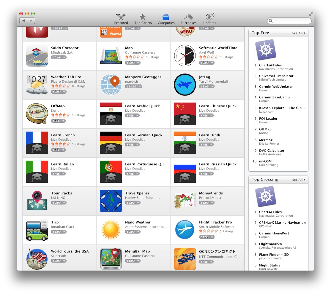
Charts&Tides is Number 1 in the Top Free and Top Grossing lists in the Travel category of the Mac App Store.
Click to find more about the software. Or you can simply download it for free.
Click to find more about the software. Or you can simply download it for free.
Charts&Tides for Mac now in the App Store!
2013 May 25 Filed in: Charts&Tides
Charts&Tides for Mac has passed review from Apple and is now available in the Mac App Store.
Some of the functionality offered in this release:
The software comes with a world base map, but does not come prepackaged with any detailed marine charts. You can purchase detailed marine charts from within the application. You can also use the software without purchasing additional charts.
Additional features coming soon:
Click to find more about the software. Or you can simply download it for free.
Some of the functionality offered in this release:
- Provides continuous and seamless large area charts derived from NOAA and CHS vector cartography.
- Shows tide levels and current speeds on the chart using easily interpreted icons. Allows you to judge the water situation around you with a single glance.
- Integrates with the ActiveCaptain interactive cruising guidebook providing you with access to thousands of marinas, anchorages, hazards and other local knowledge.
- Stores the entire ActiveCaptain database offline so that it is always available to you, even without an Internet connection.
- Allows you to instantly search thousands of chart features and the ActiveCaptain database.
- Supports waypoints, routes, tracks and allows you to import and export them in GPX format.
- Supports GPS devices that transmit in the NMEA format. Route navigation with automatic waypoint sequencing is supported.
- Comes with a dark UI that looks good during the day and will preserve your night vision when it is dark.
The software comes with a world base map, but does not come prepackaged with any detailed marine charts. You can purchase detailed marine charts from within the application. You can also use the software without purchasing additional charts.
Additional features coming soon:
- Canada charts.
- AIS support and lots of options to connect GPS and AIS devices.
- Weather.
Click to find more about the software. Or you can simply download it for free.